Detta inlägg post publicerades ursprungligen på denna sida this site ;
Date:
Author: Rss error reading .
Original article: https://theconversation.com/curious-kids-if-heat-rises-why-does-it-get-colder-in-the-mountains-252911
If heat rises, why does it get colder as you climb up mountains?
– Ollie, 8, Christchurch, New Zealand
That is an excellent and thoughtful question Ollie – why indeed?
You’re right, when air is warmed, it rises. This is what gives us the “thermals” gliders can use to soar upwards and large birds of prey like the South American condors use to help them stay aloft for hours at a time.
But there are lots of other things influencing air temperature. When air rises, it expands because air pressure decreases with height. The energy in the air gets spread out over greater volumes and its temperature goes down.
This effect wins out over warm air rising. The warm air in a thermal will cool as it rises, until it reaches the temperature of the air around it and is no longer buoyant.
But why do we have rising air at all?
That’s because the air around us is heated from below, from Earth’s surface.
When the Sun is shining, it doesn’t heat the air in the lowest few kilometres of the atmosphere (the troposphere) as there are very few gases in that air to absorb sunlight.
The Sun’s rays heat Earth, not the air. The air is then warmed from below, from the ground, just as water in a pot on a stove is warmed from the bottom of the pot.
Earth’s greenhouse
Earth mostly sends energy back to space in the form of heat or infrared radiation (with wavelengths longer than visible light but shorter than microwaves), and there are plenty of gases in the air that are good at absorbing this kind of radiation, even if they don’t feel the sun’s energy.
These are what we call greenhouse gases – water vapour, carbon dioxide, methane and so on. Because we have these in the air, the absorption of infrared energy is the main way the air is warmed.
Again, air near the ground is warmed the most by this absorption of energy.
The warm air near Earth is buoyant so it often “bubbles up” into the atmosphere, just like the water in a pot on a stove.
But in the atmosphere, the decrease of pressure with height dictates that temperatures decrease as you go up. This is what’s known in weather jargon as the “lapse rate” – how fast temperatures decrease with height. In dry air (no water vapour), that rate is just under 10°C per kilometre, or a little under 1°C cooler per 100 metres upwards.
Shutterstock/Klanarong Chitmung
When we have water vapour in the air, it’s a different story. As the air rises and cools, it can’t hold so much water vapour, so some of the vapour has to condense back into liquid water. As it does that, it releases the energy it took to evaporate it in the first place.
That heat warms the air and reduces the “lapse rate”. How big this effect is depends on how much moisture was in the air to start with. On average, the temperature decrease of about 10°C per kilometre goes down to around 6.5°C per kilometre.
And what happens to that liquid water in the air? If forms tiny droplets that make clouds. If enough of those drops stick together and become heavy enough, they’ll fall back to Earth as rain.
Clouds, rain and lightning
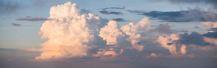
We have clouds and rain because temperatures decrease with height. The clouds that form this way, through buoyant air rising in thermals, are known as cumulus clouds.
Cumulus always have lumpy tops, looking a bit like a cauliflower. That’s because different parts of the rising air have different amounts out water vapour in them. So different amounts of energy are released, giving the air different buoyancy in different places. The moistest, most buoyant air rises the highest, while drier less buoyant air doesn’t make it so far up.
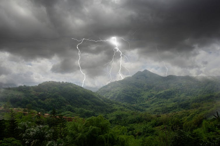
If there is lots of moisture available, we can get a thunderstorm cloud, with thunder and lightning as well as plenty of rain. Not just rain either, but often hail (frozen rain).
That happens because the temperature in the upper parts of such deep clouds is well below freezing, so it is made up of ice crystals rather than water drops. Those ice crystals can stick together to form hail, or snow.
Shutterstock/Athapet Piruksa
Curiously, it’s the collisions between ice crystals and water drops as they go up and down in a deep cumulus cloud that gives rise to lightning, with a build-up of positive electrical charges at the top of the cloud and negative charges at the bottom.
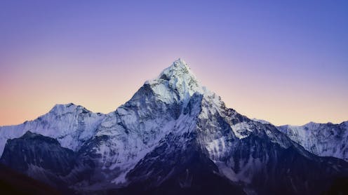
Getting back to your original question, why is it colder in the mountains? That’s because as we climb a mountain, we are moving into cooler layers of the atmosphere. We are getting above the surface layers of the atmosphere, going to lower pressures, and that causes the temperature to drop.
Warm air can still rise from a mountaintop, but it’ll be cooler to start with than air down at sea level, just because it’s at a lower pressure. Climbers who tackle really high mountains, like Mount Everest, usually take oxygen cylinders with them as the air is so thin near the top of such high peaks.
That’s also why snow and ice linger on mountain tops, as that’s where it is cold enough year-round to keep the ice frozen.
Hello curious kids! Do you have a question you’d like an expert to answer? Ask an adult to send your question to curiouskids@theconversation.edu.au. Please tell us your name, age and the city where you live.
![]()
James Renwick receives funding from the Ministry of Business, Innovation and Employment (MBIE). He is a member of the Green Party.