Date:
Author: Andrew Brown, Research Fellow in Climate Science, The University of Melbourne
Original article: https://theconversation.com/severe-thunderstorms-are-sweeping-through-southern-australia-but-what-makes-a-thunderstorm-severe-241555
Clusters of severe thunderstorms are expected to strike Australia’s southern regions over Thursday and Friday.
The Bureau of Meteorology has issued severe weather warnings and forecasts related to these unusually widespread stormy conditions as they move through South Australia today and into Victoria.
Some areas have already experienced golf ball-sized hail and intense winds.
While we might not always think of thunderstorms as a threat, severe storms can be surprisingly damaging. The enormous Sydney thunderstorm of 1999 dropped an estimated 500,000 tonnes of hail, causing widespread damage to cars and roofs. At the time, it was the most expensive natural disaster on record, overtaken only by the unprecedented 2022 floods across eastern Australia – which were themselves partly caused by severe thunderstorms in addition to other weather systems.
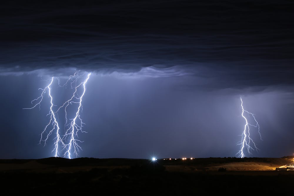
When severe thunderstorms bring torrential rain, they can often trigger flash flooding. This is because extreme rain from thunderstorms usually falls over a relatively short time – less than an hour or two in many cases. Lightning can also pose a threat.
In recent years, severe thunderstorms have also shown they can damage the power grid. In 2016, huge rotating supercell storms brought intense winds and at least seven tornadoes to South Australia, toppling transmission towers and causing a statewide blackout. Smaller thunderstorms caused major outages in Victoria in February this year after taking down six towers.
But what makes a thunderstorm “severe”?

Con Chronis/AAP
The ingredients for a storm
What triggers thunderstorms? Climate scientists and meteorologists often talk about the ingredients necessary for thunderstorms.
To make a normal thunderstorm, you need to have a lot of moisture in the air. Then you need vertical instability in the atmosphere, meaning relatively warm moist air near the surface and very cold air above. You also need a mechanism to lift warmer surface air up to a level where the atmospheric instability can be released.
For a severe thunderstorm, you need all those ingredients and usually one more: vertical wind shear. This means that wind speeds and direction differ with height. For example, you might have strong northerly winds down low, and strong southerly winds up higher.
Vertical wind shear can make a run-of-the-mill thunderstorm much more intense, in a range of ways. For instance, wind shear can help warm updrafts stay separate from cold downdrafts and rainfall, which can help make the storm last longer.
If a thunderstorm has large hail, damaging wind gusts or could trigger a tornado or flash flooding, this makes it a severe thunderstorm, according to Bureau of Meteorology classification.
You might have also heard of supercell storms. These are convective thunderstorms, characterised by strong, rotating updrafts that last for a long time.
Forecasters can predict the potential for severe thunderstorms several days out by looking for moisture-laden air and winds. But predicting exactly where and when they might pop up is extremely challenging.
cephotoclub/Shutterstock
What’s unusual about these storms?
The storms this week are unusually widespread, with thunderstorms possible from Kalbarri in central Western Australia down through Esperance, across into South Australia, into Victoria and up through New South Wales and southern Queensland.
These conditions are due to a large-scale low pressure system moving west to east.
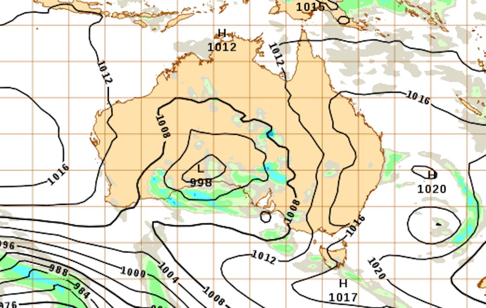
Bureau of Meteorology, CC BY-NC-ND
Ahead of the arrival of this low pressure system, winds from the north are bringing down moisture and instability and priming the system for thunderstorms. When air near the low pressure system begins to rise, energy from the warm, moisture-laden and unstable air can be released. This includes energy release due to condensation of water vapour. These rising air currents can travel several kilometres up into the atmosphere, even reaching the top of the troposphere, 10–15km up.
Severe thunderstorms in southern Australia are more likely in spring and summer. That’s because there’s plenty of moisture available from the tropics and the warm oceans around Australia, while low pressure systems and cold fronts can still emerge from the cold oceans to our south.
Thunderstorms, tornadoes and fire
Severe thunderstorms can also pack a hidden punch. They can trigger tornadoes in extreme cases.
In August, severe thunderstorms hit northern Victoria and triggered a tornado, a destructive whirling column of air that damaged houses and farms in the high country.
This surprised many people. It’s generally known that Australia has tropical cyclones in the north, intense tropical storms coming in off the sea, but not as well known to have tornadoes.
In fact, Australia does get tornadoes – an estimated 30–80 each year. In 2013, a total of 69 known tornadoes caused almost 150 injuries. Many of these tornadoes spin out of supercells.
In Australia’s hotter months, many fires burn around the country. Thunderstorms can make fires worse by bringing strong, warm northerly winds, often with rapid variations in speed and direction that can increase the rate of spread of a fire.
Firefighters and first responders dread these conditions. Australia’s most deadly bushfire was Black Saturday in 2009, which killed 173 people. One reason it was so dangerous was its suddenness. Intense northerly winds brought down powerlines and started fires, which were quickly whipped into intense firestorms, including thunderstorms generated in the fire plumes.
Will climate change bring more severe storms?
As the world heats up, more water is evaporating off warm sea surfaces and hanging in the air as water vapour. This means there’s more of this ingredient necessary to fuel severe thunderstorms and more intense rain from thunderstorms.
What we don’t know for certain yet is how prevailing air currents over Australia are changing. This could shift moisture to different regions, or affect other thunderstorm ingredients like vertical wind shear, instability, and lifting mechanisms. If circulation patterns do change, we could see severe storms develop in new areas, or different times of the year.